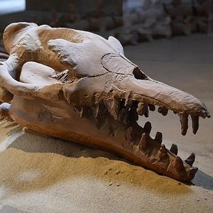
Luxor, Arabic Al-Uqṣur, also called El-Aksur, city and capital of Al-Uqṣur muḥāfaẓah (governorate), Upper Egypt. Luxor has given its name to the southern half of the ruins of the ancient Egyptian city of Thebes. Area governorate, 1,080 square miles (2,800 square km); city, 160 square miles (415 square km)
Luxor is often called the world’s greatest open-air museum, but that comes nowhere near describing this extraordinary place. Nothing in the world compares to the scale and grandeur of the monuments that have survived from ancient Thebes.
The setting is breathtakingly beautiful, the Nile flowing between the modern city and west-bank necropolis, backed by the enigmatic Theban escarpment. Scattered across the landscape is an embarrassment of riches, from the temples of Karnak and Luxor in the east to the many tombs and temples on the west bank.

Thebes’ wealth and power, legendary in antiquity, began to lure Western travelers from the end of the 18th century. Depending on the political situation, today’s traveler might be alone at the sights or be surrounded by coachloads of tourists from around the world. Whichever it is, a little planning will help you get the most from the magic of Thebes.
The Ancient Ruins
The southern part of Thebes grew up around a beautiful temple dedicated to Amon, king of the gods, his consort Mut, and their son Khons. Commissioned by King Amenhotep III (Amenophis III; reigned 1390–53 BCE) of the late 18th dynasty, the temple was built close to the Nile River and parallel with the bank and is known today as the Temple of Luxor. An avenue of sphinxes connected it to the Great Temple of Amon at Karnak. The modern name Luxor (Arabic: Al-Uqṣur) means “The Palaces” or perhaps “The Forts,” from the Roman castra.
Luxor, together with other Theban sites—Karnak, the Valley of the Queens, and the Valley of the Kings—was designated a UNESCO World Heritage site in 1979. Excavations and preservation efforts have been ongoing. In 1988 the Egyptian Antiquities Organization uncovered numerous 18th-dynasty statues at the court of Amenhotep III, and work to excavate and preserve the court continued through the following decades. In the 21st century a project began to excavate the avenue of sphinxes between the Temple of Luxor and the Great Temple of Amon at Karnak.

The contemporary city, a market town for the surrounding agricultural district, has grown north, south, and east of the temple. It has a number of churches, as a large proportion of the population is Christian, and mosques. There is also a railway station on the Cairo-Aswān railroad, an airport, and ferry service to the western bank. The Luxor Museum was opened in 1975. Numerous tourist facilities were built in the latter part of the 20th century.

there are special organized tours to discover the magic of luxor

Cairo is the capital of Egypt, and one of the largest cities in Africa. Cairo has stood for more than 1,000 years on the same site on the banks of the Nile, primarily on the eastern shore, Cairo is the gateway to the Nile delta, where the lower Nile separates into the Rosetta and Damietta branches. Area governorate, 83 square miles (214 square km). Pop. (2006) governorate, 7,786,640; (2005 est.) urban agglom., 11,128,000.
Landscape
City site
Cairo is fan-shaped, narrowest in the south, where the river valley is wedged between desert escarpments, and widest in the north, where the valley blends into the delta. Over the centuries the city expanded westward, as a receding river channel left land flood-free. In response to heightened demand, however, the city also has been elongated to the north and south and has developed an expanding annex on the Nile’s western shore.
Climate
Cairo has only two seasons: approximately eight months of summer and four months of winter. In the hottest of the summer months—June, July, and August—the average daily maximum temperature is 95 °F (35 °C), and the average daily minimum is 70 °F (21 °C). The summer temperature has reached as high as 117 °F (47 °C). During winter the strong Tropic of Cancer sun makes for warm, dry days, but nights are cool and humid, often freshened by breezes from the Nile. The average daily maximum temperature in January–February is 67 °F (19 °C), and the average daily minimum is 47 °F (8.5 °C).
People
Cairo’s population, once both ethnically and religiously diverse, is now predominantly Muslim. A significant number of Egyptian Christians, the majority of whom observe the Coptic Orthodox faith, continue to dominate certain districts in the city. Remnants of the old Italian, Greek, Syrian, and Sudanese communities are still found in some locations. Differences of status within the Egyptian population depend largely on one’s place of origin (many residents of Cairo were born in rural Egypt), class, and degree of modernity. About half of the city’s population live in the city proper, while half live in the suburbs.
Economy
Manufacturing
From its inception, Cairo’s economy has been based on governmental functions, commerce, trade, and industrial production. The modern productive sector has expanded dramatically since the middle of the 20th century. Since the 1952 revolution, large-scale industrialization has built upon previous developments in textiles (utilizing the long-staple cotton for which Egypt is famous) and food processing (which consists of canning and freezing the wide variety of fruits and vegetables grown in the fertile delta), as well as the processing of sugarcane grown in Upper Egypt. In addition to the production of iron and steel, consumer goods, particularly appliances, are manufactured in nearby factories.

Finance and other services
Cairo is the country’s primary center for economic production and financial control. It still contains many of Egypt’s important banks, hotels, restaurants, entertainment venues, and cafés.
Transportation
Egypt’s extensive transportation network, laid out by the British, connects most of the country’s urban centers with the capital. Within metropolitan Cairo, the transportation network is made up of both formal and informal sectors. The Public Transport Authority runs a bus network, which was introduced in the 1950s. In addition, a far-reaching system of authorized, licensed cabs operate in the city. Informal transportation services include minibusses and taxis, which sprang up in the late 1970s and ’80s; these continue to predominate, particularly in areas that serve the expanding informal neighborhoods. The Cairo Metro, a citywide subway system, began service in 1987 and has since been significantly expanded.

Traffic congestion is a serious problem in Cairo, particularly as both imports and local assembly plants have provided greater access to automobiles. To combat congestion and pollution, the Egyptian government built a substantial number of bypass highways and overpasses. Donkey-drawn carts, though technically outlawed, are also a common sight on Cairo’s streets, operating among the city’s automobiles, minibusses, buses, streetcars, and trolleys.

there are special organized tours to discover the magic of cairo