The Great Sphinx of Giza: The Complete Guide to Egypt’s Most Mysterious Monument
Discover the history, symbolism, hidden secrets, and fascinating mysteries of the Great Sphinx of Giza, the world’s oldest monumental statue and one of Ancient Egypt’s greatest masterpieces.
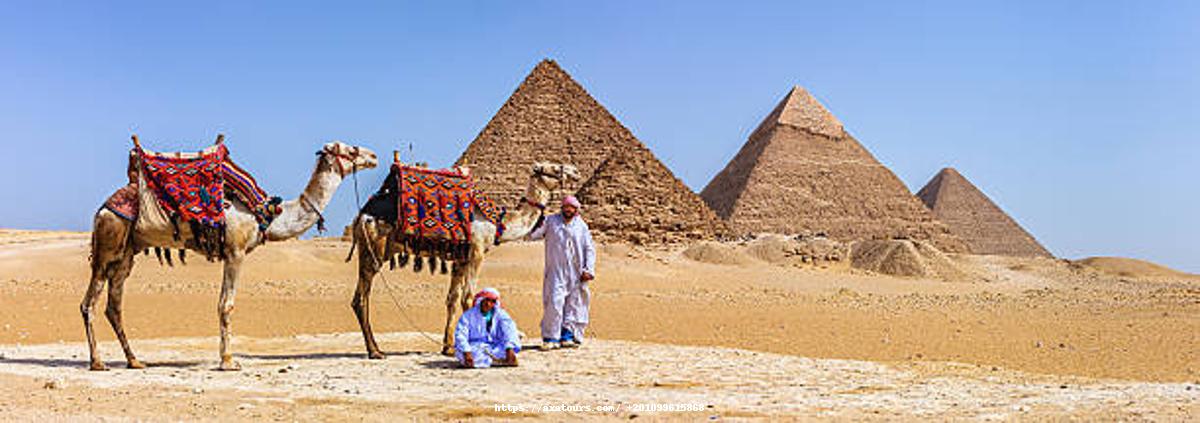
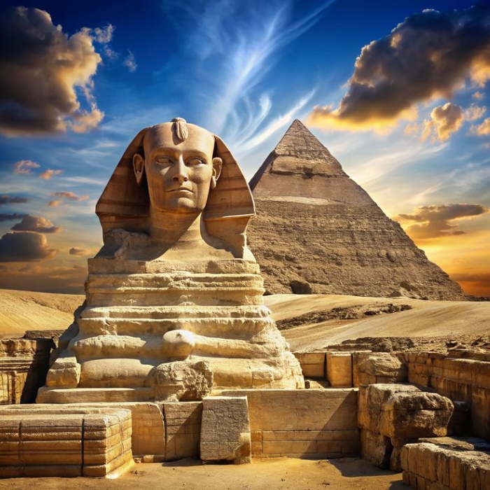
For more than 4,500 years, the Great Sphinx of Giza has stood silently on the edge of the Sahara Desert, guarding the legendary pyramids and captivating everyone who gazes upon it. Carved directly from a massive limestone ridge, this extraordinary monument combines the body of a lion with the face of a king, creating one of the most recognizable symbols of Ancient Egypt and one of the greatest archaeological achievements in human history.
Despite centuries of exploration and scientific research, the Great Sphinx continues to puzzle historians and archaeologists. Questions surrounding its construction, purpose, missing nose, and possible hidden chambers have inspired countless debates, myths, and discoveries. While many mysteries have been solved, others remain unanswered, adding to the monument’s timeless appeal.
Located within the UNESCO-listed Giza Necropolis, alongside the Great Pyramid of Khufu, the Pyramid of Khafre, and the Pyramid of Menkaure, the Sphinx attracts millions of visitors every year. It is not only one of Egypt’s most visited landmarks but also one of the most searched historical monuments worldwide.
What Is the Great Sphinx of Giza?
The Great Sphinx is a colossal limestone monument depicting a mythical creature with the body of a lion and the head of a human ruler. Unlike the winged sphinxes of Greek mythology, the Egyptian Sphinx was designed without wings and carried a very different meaning.
To the ancient Egyptians, the lion represented courage, strength, protection, and royal authority, while the human face symbolized wisdom, intelligence, and divine kingship. Together, these features expressed the ideal qualities of a Pharaoh—a ruler who possessed both physical power and spiritual guidance.
Stretching more than 73 meters across the desert and towering nearly 20 meters high, the Great Sphinx remains one of the most impressive sculptures ever produced by an ancient civilization. Even after thousands of years of erosion, its calm expression and monumental scale continue to inspire awe among visitors from around the world.
Why Is It Called the Sphinx?
Interestingly, the ancient Egyptians never used the name Sphinx.
The word originates from the Greek term Sphinge, referring to the mythical creature that challenged travelers with riddles. Greek visitors who arrived in Egypt during the first millennium BC saw similarities between their legendary creature and the colossal statue at Giza, eventually giving it the name that is still used today.
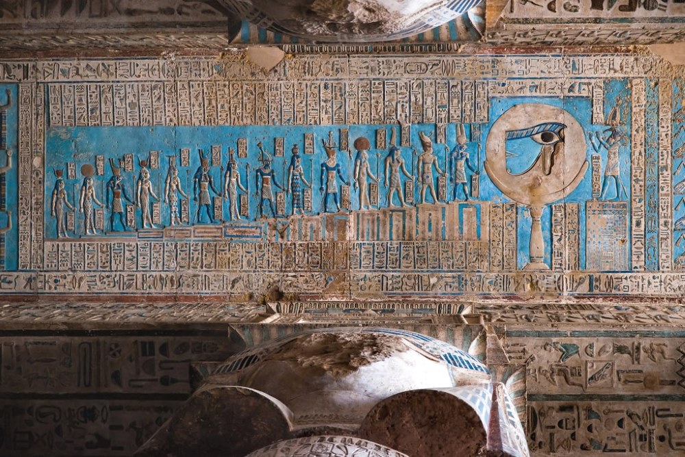
The ancient Egyptians, however, referred to the monument differently. During the New Kingdom, inscriptions describe it as Hor-em-Akhet, meaning Horus of the Horizon. This sacred title linked the monument to the falcon god Horus and emphasized its connection with the rising sun, divine protection, and eternal kingship.
When Was the Great Sphinx Built?
Most Egyptologists agree that the Great Sphinx was carved around 2500 BC, during Egypt’s Fourth Dynasty, making it approximately 4,500 years old.
Although no surviving inscription explicitly states who ordered its construction, archaeological evidence strongly suggests that it was built during the reign of Pharaoh Khafre, the ruler responsible for the second-largest pyramid at Giza.
Several important discoveries support this conclusion. The Sphinx is physically connected to Khafre’s pyramid complex, and many of the limestone blocks removed during its excavation were later reused to build the nearby Valley Temple. Furthermore, the style of the monument closely matches the artistic traditions of the Fourth Dynasty.
While alternative theories continue to attract attention, Khafre remains the most widely accepted builder among historians and archaeologists.
Who Built the Great Sphinx?
The identity of the Sphinx’s builder remains one of the most debated subjects in Egyptology. Although no ancient document definitively answers the question, three main theories have emerged.
The Khafre Theory
The dominant scholarly view attributes the monument to Pharaoh Khafre, who ruled Egypt between approximately 2558 and 2532 BC.
This theory is supported by several key observations:
The Sphinx lies within Khafre’s funerary complex.
Limestone removed during its carving was reused in Khafre’s Valley Temple.
Architectural alignment links the monument with Khafre’s pyramid.
The facial proportions resemble statues of Khafre discovered nearby.
Although the evidence is circumstantial rather than definitive, it forms a convincing case accepted by most Egyptologists.
The Older Civilization Theory
Perhaps the most controversial hypothesis suggests that the Great Sphinx predates the pyramids by thousands of years.
Advocates point to erosion patterns on the monument, claiming they were caused by prolonged rainfall rather than wind and sand. Because Egypt experienced wetter climatic conditions long before the rise of the pharaohs, they argue that the Sphinx could date to between 7000 and 9000 BC.
Most geologists and Egyptologists reject this interpretation, explaining the erosion through a combination of natural weathering, groundwater, salt crystallization, and differences in limestone quality. Moreover, no archaeological evidence has been found to support the existence of an advanced civilization in Egypt capable of carving such a monument before the dynastic period.
For now, the traditional dating to the reign of Khafre remains the strongest and most widely accepted explanation.
Why Was the Great Sphinx of Giza Built?
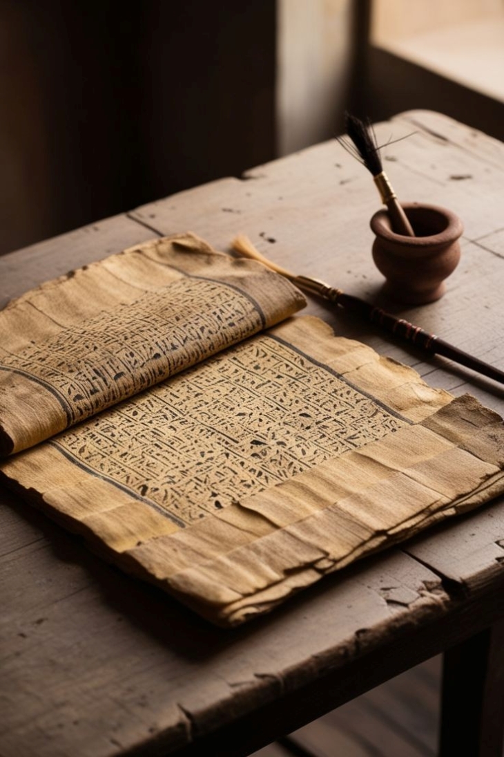
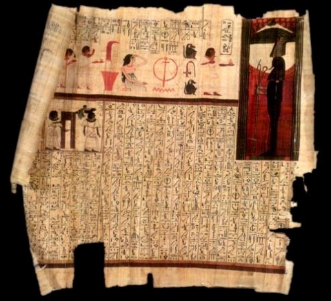
Among all the questions surrounding the Great Sphinx of Giza, perhaps the most intriguing is not how it was constructed, but why it was created in the first place. Despite the wealth of inscriptions left by Ancient Egyptian civilization, no surviving text from the Fourth Dynasty clearly explains the monument’s original purpose. This absence of direct evidence has inspired centuries of archaeological research and scholarly debate.
By examining the Sphinx’s location, design, symbolism, and relationship to the surrounding pyramids and temples, historians have developed several convincing theories. While no single explanation answers every question, together they reveal the monument’s profound religious, political, and symbolic significance.
The Eternal Guardian of the Giza Pyramids
The most widely accepted interpretation is that the Great Sphinx was built to serve as the guardian of the Giza Necropolis, protecting the sacred burial complex of Egypt’s kings.
Throughout Ancient Egypt, colossal statues were often positioned at the entrances of temples and tombs to ward off evil forces and safeguard holy places. The Great Sphinx fulfills this role on an extraordinary scale.
Standing directly before the Valley Temple of Pharaoh Khafre and overlooking the royal pyramids, the monument appears to watch over the necropolis with unwavering vigilance. To the ancient Egyptians, it was far more than an impressive sculpture—it was a sacred protector ensuring that the Pharaoh’s eternal resting place remained secure for eternity.
Its strategic location was carefully chosen to emphasize this protective function, reinforcing the sacred nature of one of the most important religious landscapes in the ancient world.
A Monument to Divine Kingship
The Great Sphinx was also a powerful political and religious statement.
In Ancient Egyptian belief, the Pharaoh was not simply the ruler of the country; he was considered the earthly representative of the gods and the guardian of Ma’at, the universal principle of truth, harmony, justice, and cosmic balance.
By combining the powerful body of a lion with the face of a king, the Sphinx visually proclaimed that the Pharaoh possessed both unmatched physical strength and divine wisdom.
Anyone approaching the royal pyramids would immediately recognize the king’s supernatural authority. Even after death, the Pharaoh continued to protect Egypt, maintaining order both in the earthly world and in the afterlife.
The monument therefore symbolized the eternal nature of royal power, reminding future generations that a Pharaoh’s influence never truly ended.
A Sacred Connection to the Rising Sun
One of the most remarkable features of the Great Sphinx is its precise orientation.
Unlike the nearby pyramids, which were aligned according to the cardinal directions, the Sphinx faces almost perfectly east, greeting the sunrise every morning.
For the ancient Egyptians, the daily journey of the sun represented one of the greatest miracles of creation. Each dawn symbolized:
As the first rays of sunlight illuminated the Sphinx’s face, they reinforced its association with rebirth and immortality.
Many Egyptologists believe this alignment was intentional, linking the monument to the sun god and the Pharaoh’s hope of being reborn each day, just as the sun itself rose again after every night.
The Dream Stele of Thutmose IV
One of the most famous stories connected with the Great Sphinx dates to around 1400 BC, during the reign of Thutmose IV.
By this time, drifting desert sand had buried almost the entire monument, leaving only its head visible above the dunes.
According to an inscription carved on the granite Dream Stele, the young prince Thutmose rested beneath the Sphinx while hunting in the desert. As he slept, he dreamed that the monument spoke to him, promising that if he removed the sand covering its body, he would become the next ruler of Egypt.
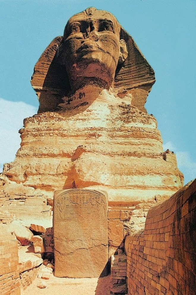
When Thutmose eventually ascended the throne, he honored this promise by organizing one of history’s earliest recorded archaeological restoration projects. Workers cleared away the accumulated sand, repaired damaged sections of the monument, and erected the Dream Stele between the Sphinx’s paws to commemorate the event.
Today, this remarkable inscription remains one of the most important historical records associated with the Great Sphinx and offers valuable insight into the monument’s enduring religious significance during the New Kingdom.
The Great Sphinx Mysteries: Secrets That Continue to Puzzle the World
For thousands of years, the Great Sphinx of Giza has inspired curiosity, legends, and endless debate. Although archaeologists have uncovered much about Ancient Egypt, the Sphinx still refuses to reveal all of its secrets. Questions about its missing nose, mysterious tunnels, hidden chambers, and even its true age continue to attract researchers and travelers from around the globe.
Its silent expression has witnessed the rise and fall of civilizations, yet many aspects of its history remain uncertain. This combination of historical fact and enduring mystery is one of the reasons the Great Sphinx remains one of the world’s most fascinating monuments.
The Mystery of the Missing Nose
Perhaps the most recognizable feature of the Great Sphinx today is the absence of its nose. Visitors from around the world often wonder what happened to this enormous piece of stone and why such a magnificent monument was damaged.
Over the centuries, numerous stories have attempted to explain the missing nose. Some are based on historical evidence, while others have become popular myths repeated for generations.
Did Napoleon Destroy the Sphinx’s Nose?
One of the most famous legends claims that Napoleon Bonaparte’s soldiers used cannons to destroy the Sphinx’s nose during the French campaign in Egypt in 1798.
Although this story appears in many books and documentaries, historians agree that it is almost certainly false.
The strongest evidence comes from the Danish explorer Frederic Louis Norden, who visited Egypt in 1737. His detailed sketches clearly show the Great Sphinx without its nose—more than sixty years before Napoleon arrived.
These drawings prove that the damage had already occurred long before the French expedition. Today, scholars regard the Napoleon story as an enduring myth rather than historical fact.
What Is the Most Accepted Explanation?
The explanation most widely accepted by historians comes from the fifteenth-century Egyptian historian Al-Maqrizi.
According to his account, a religious man named Muhammad Sa’im al-Dahr became angry after seeing local farmers leaving offerings near the Sphinx in hopes of receiving blessings for successful harvests.
Believing these rituals represented idol worship, he deliberately damaged the monument by striking its nose.
Historical records indicate that local authorities later punished him for vandalizing one of Egypt’s sacred monuments.
Although no eyewitness account survives from the event itself, this explanation remains the most credible historical theory.
Could Nature Be Responsible?
Time has also played an important role in shaping the appearance of the Sphinx.
For more than four millennia, the monument has been exposed to:
Powerful desert winds
Sand erosion
Earthquakes
Temperature changes
Salt crystallization
Occasional flooding
Human interference
Because the nose projected prominently from the face, it was naturally more vulnerable than the surrounding stone.
Many experts believe that natural weathering weakened the structure over time, making it easier for deliberate damage to remove the remaining section.
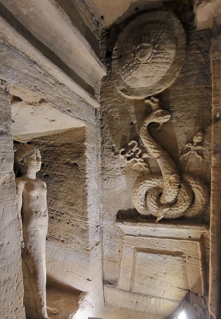
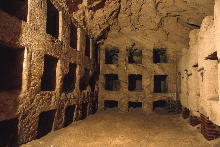
Are There Hidden Chambers Beneath the Sphinx?
Few archaeological questions have generated as much excitement as the possibility of secret chambers beneath the Great Sphinx.
Modern scientific investigations have detected several underground anomalies, including natural cavities, small tunnels, and ancient repair shafts.
However, no excavation has uncovered hidden treasure, royal tombs, or underground cities.
Although the idea remains popular in books and documentaries, current archaeological evidence does not support the existence of vast hidden chambers beneath the monument.
The Legend of the Hall of Records
Perhaps the most famous mystery associated with the Sphinx is the legendary Hall of Records.
During the twentieth century, American psychic Edgar Cayce claimed that an underground library filled with ancient knowledge lay hidden beneath the monument.
According to his visions, the chamber supposedly contained records from the lost civilization of Atlantis and preserved the forgotten history of humanity.
The story captured the public imagination and became one of the greatest legends in modern Egyptology.
Despite numerous investigations using ground-penetrating radar, seismic surveys, and advanced scanning technology, archaeologists have never found evidence supporting the existence of such a chamber.
Today, the Hall of Records remains an intriguing legend rather than an archaeological reality.
Is the Great Sphinx Older Than the Pyramids?
One of the most controversial debates concerns the age of the Great Sphinx itself.
While mainstream archaeology dates the monument to around 2500 BC, geologist Dr. Robert Schoch proposed that unusual erosion patterns on the Sphinx were caused by heavy rainfall rather than wind.
Because Egypt experienced wetter climatic conditions thousands of years before the pharaohs, Schoch suggested that the monument might have been carved between 7000 and 9000 BC.
If proven true, this theory would dramatically change our understanding of human civilization.
However, the majority of geologists and Egyptologists disagree. They argue that the erosion can be explained by natural weathering, groundwater, salt deposits, and differences in limestone quality.
Since no archaeological evidence supports the existence of an advanced civilization in Egypt before the dynastic period, the traditional dating remains the most widely accepted.
Secret Tunnels Inside the Monument
Although there is no hidden city beneath the Sphinx, several passages do exist within the monument itself.
Archaeologists have documented:
A shaft in the top of the head
Small maintenance passages
Ancient restoration tunnels
Natural cracks within the limestone
Most of these openings were created during conservation projects or resulted from natural geological processes.
None has revealed hidden treasures or mysterious underground civilizations.
Was the Great Sphinx Designed for the Stars?
The precise orientation of the Great Sphinx has inspired another fascinating theory.
Because it faces directly east, the monument greets the rising sun every morning. During the spring and autumn equinoxes, the sunrise aligns beautifully with the Sphinx, creating a spectacular visual effect across the Giza Plateau.
Some researchers also believe the lion-shaped body symbolizes the constellation Leo, suggesting the monument reflects ancient astronomical knowledge.
Although these ideas remain speculative, they highlight the remarkable planning skills of Ancient Egyptian architects and their deep understanding of celestial movements.
Discover more about the Sphinx and Giza Pyramids with Axatours.
Get ready for the ultimate Egyptian adventure! With Axatours, we take you on exclusive, expertly curated tours of the Sphinx, designed to immerse you in the heart of Egypt’s rich culture and history. Our experienced team will guide you every step of the way, ensuring an unforgettable journey. For more details and exclusive offers, click the link here and start planning your dream trip!
Written by ATW July 2026.